
BRITS are in for a “dull and damp” weekend with yet more rain and gale force winds on the way.
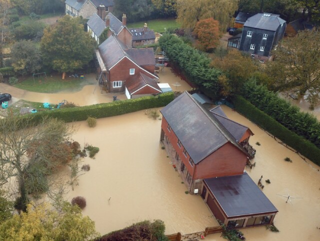
The wet weather brings a high risk of flooding, with a total of 43 warnings and alerts in place across England and Wales.
A driver enters a flooded road in Bournemouth, Dorset
Chaos on the A20 at Aylesford in Kent
Severe flooding in Uckfield, East Sussex
After several days of wild conditions, which plunged the UK’s train network into chaos and saw planes struggling to land, things will settle slightly today.
Despite overnight temperatures dropping to -3C in sheltered parts of northern England and Scotland and a scattering of showers in the north, west and far southeast, most places will be fine and dry.
But it won’t stay that way for long.
A band of heavy rain and strong winds will sweep eastward across the UK first thing tomorrow, the Met Office has warned.
Gusts will reach gale force in coastal areas and western Scotland and most regions will see significant downpours.
The forecast has pushed the Environment Agency and Wales Natural Resources Wales to issue flood warnings and alerts.
Flooding is “expected” in eight areas of England, mostly in the South East, while 30 alerts covering a similar patch say it is “possible”.
A further five alerts have been issued for near Cardiff and the Brecon Beacons National Park.
Those living in high risk zones should move important items upstairs, vehicles to higher ground and turn off their gas, electricity and water supplies if it is safe to do so.
Met Office meteorologist Aiden McGivern said: “More autumnal, breezy and showery conditions to come this weekend.
“A relatively calm start in terms of wind on Saturday morning but chilly with temperatures in low single figures in urban areas and more sheltered spots down below freezing so a touch of frost.
“Then cloudy, breezy and wet weather arrives accompanied by strong winds, just about touching gale force.
“The rain will be largely light and patchy by the afternoon, but into the evening and overnight it will pick up over the southeastern corner.
“It will be a breezy day for most on Sunday with further showers coming in from the west. These will be lively with thunder and gusty winds once again, pepping up in the afternoon and evening.
“There is more unsettled weather into next week with spells of rain and wind, especially towards the west, but temperatures will continue to rise.”
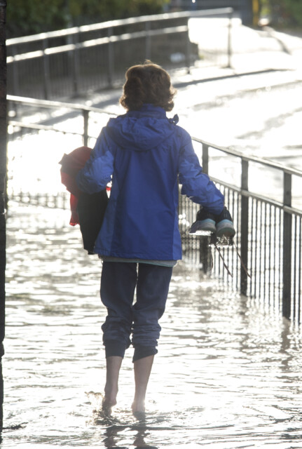
A walker removes their shoes to walk through a flooded road in Bournemouth, Dorset


