
BRITS have been hit with weather warnings as snow and ice are set to sweep parts of the country in a Boxing Day bone chiller.
The Met Office has issued two yellow weather warnings, with travel chaos likely and even the chance of power cuts.
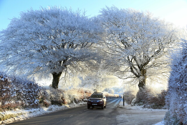
Snow and ice are expected in some parts of the country| Glasgow, Scotland
The Met Office has issued two yellow weather warnings

Bold Brits braved freezing waters for a Christmas dip in Wales yesterday| Porthcawl, Wales
The first warning covers most of Scotland, with all but the most eastern parts expected to see snow and ice.
Snow showers and icy roads are expected to hit Scots with a freezing double whammy, making disruption on roads likely, especially on higher ground.
The Met even say that there is a small chance of “disruption” to power supplies in the region.
The warning was activated at 9pm last night and lasts until 6pm this evening.
Meanwhile, a second warning, this one just for ice, covers Northern Ireland.
Forecasters warn that injuries from slips and falls on ice should be expected.
However, icy patches are only expected earlier in the day, with the warning lasting from the early hours of this morning until 10am.
Both warning areas will see temperatures between 1C and 3C for much of the day.
It comes after bold Brits were seen braving the freezing cold to go from a Christmas dip in the icy waters around Coney Beach, Wales.
Keen swimmers in Santa-themed swimwear took the plunge despite finger-numbing temperatures as part of a bizarre festive tradition.
Further south, though, the outlook is far milder with highs of around 8C across much of the south coast, while the Midlands are expected to see temperatures hovering around 5C.
It is forecast to be dry in most parts for Boxing Day, but a band of very heavy rain is sweeping in from across the Atlantic and is set to batter the UK over the next two or three days.
The Met’s forecast for this week predicts a cold week, with wintry showers in the North.
By the end of the week they expect: “Spells of rain spreading across most areas on Wednesday with blustery showers following Thursday. Gales in many areas. Further rain and strong winds spreading in Friday.”
Into next week, including New Year’s Eve, the forecaster predicts: “Probably dry across many areas at first on Friday, but showers that could be locally heavy at times likely to spread from the southwest throughout the day, and some risk of hill snow.
“Windy conditions likely, with gales possible across higher ground and towards the coasts. Temperatures close to the seasonal average. Weather remaining changeable into the New Year, with rain and showers most frequent in the west and northwest.
“Mild in the south for the later part of the period, whilst the north sees a mixture of milder and colder spells.”

The icy dip is a bizarre local Christmas tradition| Porthcawl, Wales
The snow and ice is expected to cause travel chaos| Exmoor, Devon


