
BRITS are set to be hit with a -2C bone chiller on Christmas Day as the Met Office reveals snow verdict.
Forecasters say a white Christmas looks unlikely in the south but remains a chance up north.
Snow, seen on the beach in Sunderland, could fall on Christmas Day in the north
Christmas shoppers and commuters battle against the wind and rain on Waterloo Bridge, London

A woman seen jumping over a puddle during heavy rain in Greenwich in South east London
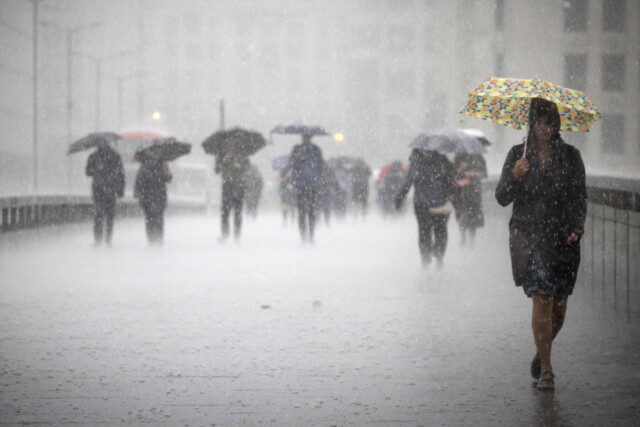
People cross London Bridge during a heavy rainfall in London
Temperatures are set to dip to at least -2C in Scotland as the rest of the country faces unsettled conditions.
Rain is expected to batter parts of the UK on Christmas Day with the mercury expected to dip in northern parts.
Periods of wet weather are likely to run west-to-east across the country, bringing a threat of snow where they meet the colder air.
Forecaster Nicola Maxey said: “That split is going to emerge mid-week with some colder air returning to the north.
“It won’t be as cold but it will increase the likelihood of wintry showers going into the weekend.
“How far south that snow will fall is still uncertain.”
Temperatures likely to be cold in the north and milder further south in general, but the Met Office says a downward trend is likely across all areas.
Average to below average temperatures will be felt around the country as a whole most likely over the festive period.
Temperatures jumped by up to 24C this week after warmer air arrived from the Atlantic, ending a two-week freeze.
Day temperatures soared to 15.8C in Rhyl, Denbighshire.
Benson in Oxfordshire went from -12C last week to 12C, and Keswick in Cumbria saw an overnight double-digit rise from 0C to 14C.
Expert Dr Stephen Burt, at the University of Reading, said the rise was extraordinary.
He added: “Mild and humid tropical air from Madeira transported quickly north and eastwards, displacing the cold airflow.”
Wednesday is expected to see rain clearing in the southeast by lunchtime.
Blustery showers will continue in the north but will be drier with sunny spells further south.
It’s set to be mild in the south but temperatures near normal elsewhere.
Later in the week will see generally unsettled and mild periods with spells of rain for southern and central parts.
There’s an increasing risk of snow in the north later on with increasingly wintry conditions in far north with showers.


