
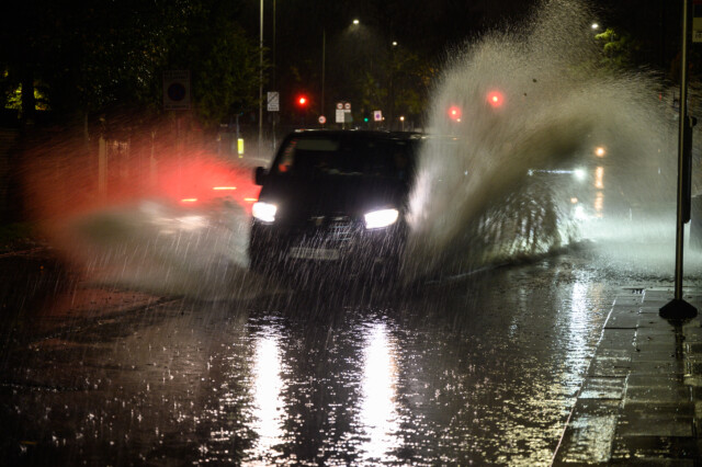
WILD weather is wreaking havoc on Britain’s roads as Storm Claudio takes hold.
Warnings for torrential rain and howling winds are in force for much of the UK before temperatures plunge to as low as -2C.
A car attempts to pass through a flooded road in Willesden in North London
A commuter attempts to shelter during heavy rain in Greenwich, south east London
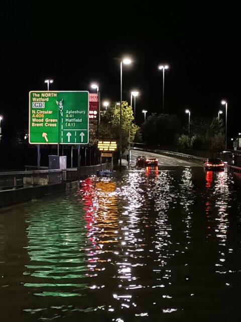
Flooding on Hendon Way / North Circular junction in London
The French squall has already brought heavy downpours and flash flooding.
But the fierce conditions look set to continue through today and overnight.
A yellow warning for rain is in place for southeastern England until 3pm where “persistent” showers and 1.5inches are expected.
Spray and flooding on roads will increase journey times and homes and businesses are at risk of being engulfed.
A separate alert for “very strong winds” of up to 70mph covers northern Scotland until 8am.
But most of the UK can expect autumnal weather and highs of just 13C.
It was a soggy start for commuters in London who face water-logged stations and streets this morning.
Several Tube and train lines are closed thanks to the conditions, while some roads are shut off by police.
Elsewhere, fallen trees are blocking paths in parts of Sussex and planes are struggling to land in Bristol.
Conditions may clear slightly this afternoon, but “patchy frost” will arrive in central and northern areas tonight.
The mercury will hover in single figures, dropping as low as -2C in rural parts of Scotland.
On Friday, Brits will get some respite with “lengthy spells of sunshine” amid scattered showers in coastal areas.
And into the weekend, more rain will push through, lingering mostly in southeast England.
Met Office meteorologist Clare Nasir said: “It’s changeable over the next few days – wind, rain, showers interspersed with some sunshine and chilly mornings.
“Two areas of concern. Some severe gales across the north and west of Scotland, that’s where we’ll see the strongest winds and also some heavy rain.
“Also some rain which will become persistent and fairly relentless across the south east so some surface water issues.
“The wind will be incredibly strong. Severe gales as that rain gradually moves its way northwards.
“All change as we head into next week. Yes, it’s still going to be windy with some showers, but there will be some higher temperatures and the nights won’t be as cold.”
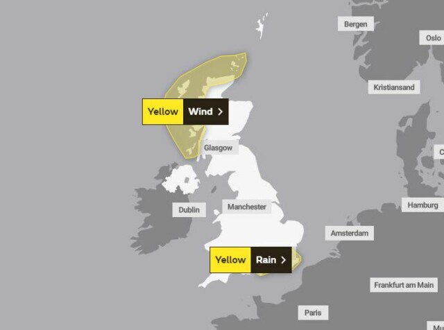
Two yellow weather warnings are in force
A van negotiates a flooded section of the A1 in London
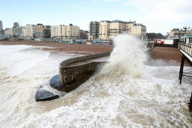
Waves crashing onto the groyne next to the Palace Pier in Brighton, East Sussex
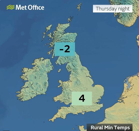
Temperatures will plunge to -2C tonight


