


THE MET Office has issued an urgent AMBER weather warning for tomorrow – amid fears snow will cause more travel chaos.
The amber warning covers a strip in the centre of the UK, and is in place from 3pm tomorrow.
The wild weather is set to bring more travel chaos in coming days


And much of the UK is also covered in yellow weather warnings for snow and ice, too.
It comes after much of the country woke to snow this morning, with the white stuff blanketing parts of the country.
The warnings are in place for both tomorrow and Friday – covering Bradford, Leeds and most surrounding areas up to Durham.
And surrounding the amber warnings, the country is littered with yellow weather warnings, too.
For the amber areas, the Met Office warned: “Heavy snow is likely to cause significant disruption on Thursday afternoon and Friday morning.”
Forecasters said people should expect: “Travel delays on roads, stranding some vehicles and passengers, some delays and cancellations to rail and air travel are likely.”
They also said: “There is a good chance that some rural communities could become cut off, power cuts are likely and other services, such as mobile phone coverage, may be affected.”
Meanwhile, temperatures dipped to a bitter -15.2C in Kinbrace in the Scottish Highlands overnight.
Met Office said this was the coldest night of the year so far.
Forecasters had issued three snow and ice warnings for across the UK today – the southeast and southwest of England, parts of Yorkshire and the North East, and northern Scotland, along with areas of Northern Ireland including Belfast.
Up to four inches was expected by the end of the day over higher ground.
Today is the second of four days hit with yellow weather alerts – with snow yet again expected across large parts of the UK tomorrow and on Friday.
The Met Office warns: “Ice and some snow leading to difficult travel conditions in places.
“Some roads and railways likely to be affected with longer journey times by road, bus and train services. Some injuries from slips and falls on icy surfaces.
“Probably some icy patches on some untreated roads, pavements and cycle paths.”
Heavy snow has forced roads to close across Surrey and Hampshire, with the National Highways issuing a “severe” warning for drivers in the South East and South West.
Motorists are advised to plan ahead and expect disruption and delays.
Wiltshire Police this morning warned: “Very heavy snow overnight is making driving conditions very dangerous.
“If your journey is not necessary please do not drive.”
All arriving and departing flights have been suspended at Bristol Airport until 11am following heavy snowfall.
A Wizz Air flight travelling from Dublin was unable to land due to the wintry conditions.
A spokesperson said: “Passengers are advised to contact their airline for specific flight information prior to travelling to the airport and please take extra care.”
Bristol Airport has temporarily grounded all flights until 11am.
In a statement on social media they said: “The Bristol Airport teams are working hard on snow clearing operations, but as the snow continues to fall, flight operations have been suspended until 1100.
“For the latest flight information please check with your airline.”
And multiple aircrafts are reportedly being held near London City Airport, Gatwick and Heathrow, due to the weather.
Gatwick Airport said some passengers experienced “minor delays” on Wednesday morning but “the airport is open and flights are operating”.
There are also minor delays on the District Line on the London Underground due to ice on the tracks.
A string of schools have closed due to the chilly conditions.
And forecasters say there is a chance that rural communities could be cut off for several days.
People should be prepared for long interruptions to power supplies, gas, water, telephone and mobile phone coverage, they added.
They warned: “Bus and train services may be delayed or cancelled, with some road closures and longer journey times possible.
“Power cuts may occur and other services may be temporarily affected.
“Untreated pavements and cycle paths might be impassable with a chance of injuries from slips and falls on snow-covered or icy surfaces.”
The first dumping of snow hit on Tuesday and will continue well into Friday.
While forecasters are unclear if the white stuff will settle today in the South, the snow is more likely to settle when it moves across much of northern England, Northern Ireland and much of Scotland on Thursday.
Met Office spokesman Stephen Dixon said snow should fall where cold Arctic air moving south towards the UK meets warmer air moving up from the South West.
He added: “As we move into the weekend as that low pressure has moved out from the East, there is a further band of rain likely to move from the South West, which could knock against cooler air and create sleet showers.
“Next week there will be a gradual warming back to something a little bit more typical for the time of year.”
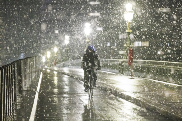
A cyclist makes his way through heavy snowfall on Westminster Bridge, London

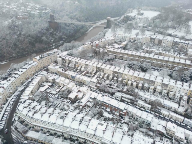
Bristol was blanketed in snow overnight amid freezing temperatures

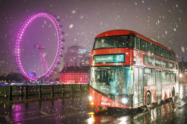
Snow falling at sunrise in central London this morning
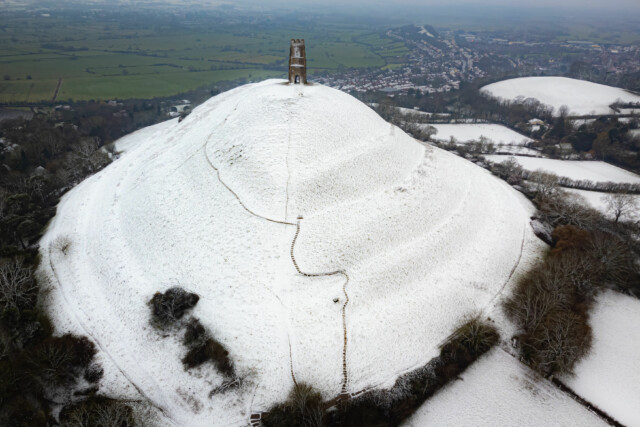
Snow settles on Glastonbury Tor, Somerset


