
NEW Year’s Eve could be a white-out if temperatures plunge to a bitter -11C.
Long-range forecasts suggest heavy snow and wintry conditions could hit some areas just in time to ring in 2023.
The natural ice rink in Upware, Cambridgeshire, which melted due to the warmer weather
Swimmers walk on a snow covered Cullercoats Bay on the North East coast
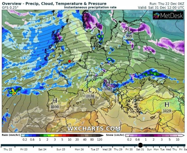
Weather charts show forming over parts of Scotland on New Year’s Eve
The post-Christmas cold snap is expected to strike on December 26 and last well into January.
WX weather charts indicate it may even continue for several weeks, with -11C winds predicted for northern England and Scotland.
It could see a repeat of this month’s icy blast, which caused chaos on Britain’s roads, railways and runways.
The mercury fell to as low as -17.3C in Braemar, Aberdeenshire – the coldest temperature since February 11, 2021 – before rising dramatically during what was dubbed the “big thaw“.
Thousands of homes across the UK were left without water after the jump caused pipes to burst.
No weather warnings are currently in force, but the Met Office has predicted “frequent wintry showers” from Monday.
There is a chance of snow on Boxing Day before becoming significantly more likely over the period to January 4.
The forecast reads: “Probably a fairly windy and changeable period of weather, with rain, and some snow at times, interspersed with colder, brighter spells.
“Around the turn of the year, uncertainties in the forecast increase, but a ridge of high pressure may bring a quieter interlude for many with more widely colder conditions, overnight frost and crisp, sunny days.
“Some wintry showers are also possible, especially in coastal areas.”
While “confidence remains low” through to January 19, forecasters have said they expect it to be “wet and windy” with “the chance of some snow”.
Temperatures will be around or a little below normal, with colder conditions developing mid-way through the month.
Meteorologist Alex Deakin said: “After Christmas, a mild start then turning colder with snow possible in some places.”
The wet weather may add to the existing flood fears in place across England.
Three warnings and 21 alerts are in force, primarily across the Midlands and south.
FREEZE-THAW
Despite the potential downpours, many Brits face a dry Christmas as Southern Water has failed to fix burst pipes near their homes.
With just days to go, emergency bottled water stations have been set up in the impacted areas, and the water supplier has promised to deliver supplies to vulnerable people who can’t collect it.
Bob Collington, chief operating officer, said: “We are currently facing significant pressure on our water supply in parts of Hampshire, caused by a combination of factors including leaks resulting from the recent ‘freeze/thaw’ event.
“This has meant demand for water is outstripping the ability of our water treatment sites to keep taps running.
“We have worked hard to solve this issue, tackling leaks and stabilising supply, however in the last 24 hours we have had to make the difficult decision to reduce supply in order to protect critical Hampshire infrastructure like hospitals.
“This means that a significant number of homes are without water or have low pressure and this is likely to be ongoing until at least Friday.
“We are very sorry for the disruption and inconvenience this is causing, particularly in the days before Christmas.
“We are working as hard as we can to resume full service by Sunday.”
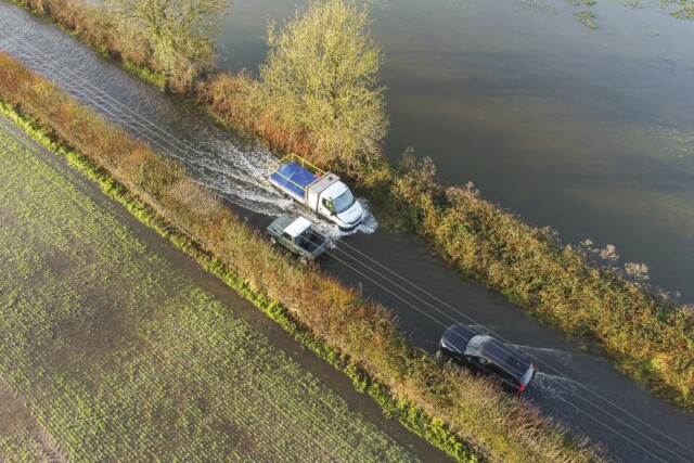
A vehicles drives through floodwater on a road near Dorchester in Dorset
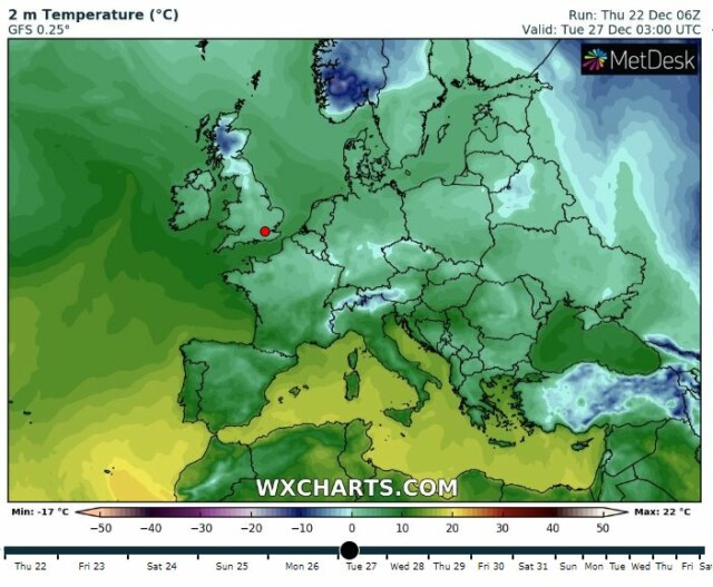
Temperatures are expected to fall after Christmas
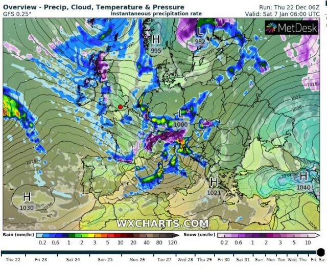
Weather charts show snow could last well into January


