
BRITS have been hit by snow in parts of the UK as temperatures tumble while urgent rain and gale warnings have also been issued.
After wet and windy conditions this week, the nation is now preparing for chilly weather with near freezing temperatures potentially on the way.
Cairngorm National Park in Scotland saw the first snow of the winter
A 4×4 battles through the snow at Cairngorm Mountain
![]()
Temperatures are set to tumble towards freezing tonight
![]()
While a yellow weather warning is also in force in northern Scotland
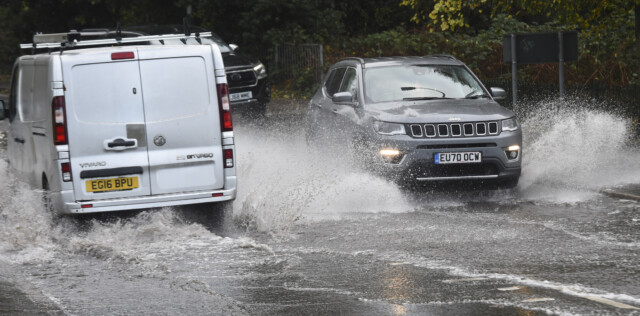
Rain and gales could also continue after flooding in East London this morning
Parts of the UK could see temperatures as low as 2C tonight after a cold wintry day, according to the Met Office.
The Met Office released a yellow weather warning for ice across eastern parts of Scotland coming into force at 8pm tonight and ending at 9.30am tomorrow morning.
And a yellow warning for rain has also been issued by the weather service for some Brits.
The warning covers areas of South West England and South Wales between 6am and 6pm on Monday, with gusts of 55mph to 65mph on land, and 70mph to 80mph in coastal areas.
It means flooding disruption to homes and businesses is likely while journey times will also be affected.
Met Office meteorologist Alex Burkill said that two areas of low pressure were set to bring “very wet and windy weather”.
He said: “We’ve got two areas of low pressure that are coming towards the UK tonight and into tomorrow.
“First one’s towards the north-west of Northern Ireland and the second one’s coming up in Ireland and South West England.
“They’re going to bring some very wet and windy weather.”
He said that while there is uncertainty around the weather on Monday, there is a risk of strong winds in coastal parts of Cornwall, Devon and South Wales.
Mr Burkill said: “Tomorrow, it’s worth bearing in mind there’s a bit of uncertainty around this, so different models are doing slightly different things with the track of that low pressure.
“Particularly on your coastal parts of Cornwall, Devon and South Wales, there is the risk of some significantly strong winds.”
He said that the winds could impact travel from airports in the region, such as Cardiff Airport and Exeter Airport.
Mr Burkill added that while no warning was in place yet, there could also be “significant” rain in western areas of Wales and Northern Ireland on Monday.
“There could be some significant rain,” he said.
“We don’t have a warning as of yet. But, you know, it’s not out of the question.”
Temperatures are also expected to drop to as low as -4C (24.8F) in parts of the country on Monday morning.
“It’s going to be quite cold towards particularly north-eastern UK,” he said.
“So, temperatures around minus four perhaps. And so that that brings the risk of ice and fog, so it’s difficult driving conditions there.”


