
BRITS have woken up to snow and ice warnings as temperatures are set to fall to -4C.
Large parts of Cumbria have been covered ahead of a freezing week for the UK.
Brits have woken up to snow and ice warnings as temperatures fall to -4C
A snow plough is seen driving through the Cumbrian village of Nenthead
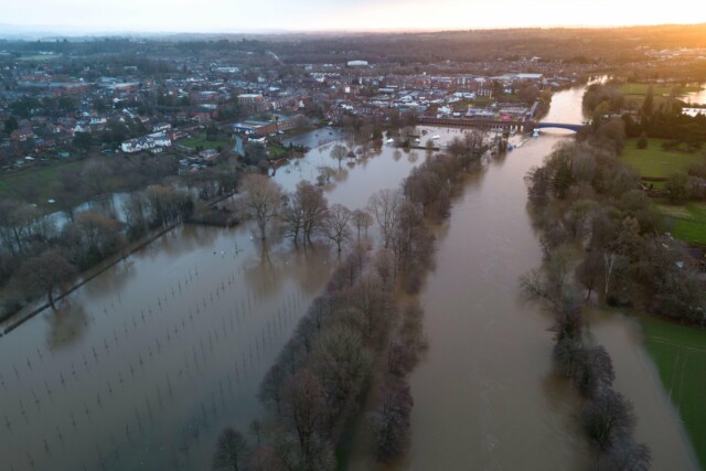
Flood warning are also in place as water levels rise. Pictured this morning in Worcestershire.
Snow ploughs were seen driving through the town on Nenthead to clear the roads this morning.
Temperatures are also set to dip to -4C on Tuesday in Kendal, Cumbria, and Dumfries in Scotland, Met Office maps show.
The meteorologists’ five day forecast suggests the weather will be “turning colder with increasingly wintry showers from the north”.
Tonight it expects further snow showers in the north with a widespread frost.
And from tomorrow it will be cold, particularly in the north, with some sharp overnight frosts throughout the week.
A warning for ice covering much of Scotland and the north-west and north-east of England suggests there could be “icy surfaces and high-ground snow leading to some difficult travelling conditions in places” this morning.
Expected “frequent wintry” snow showers have also seen the Met Office issue a lengthy warning for snow and ice for northern Scotland from today through to Wednesday.
The Met Office said: “A few centimetres of snow are likely at low levels over a given 24-hour period, with the potential for 10-15cm above 200 metres, especially across parts of the Highlands. Ice will be additional hazard, especially Tuesday night.”
Residents are urged to take care as there may be some icy patches on some untreated roads, pavements and cycle paths and some roads and railways are likely to be affected with longer journey times by road, bus and train services.
The forecaster said: “By Sunday most of the UK will be in the northerly airflow, with lower temperatures spreading further south overnight.
“Showers will fall increasingly as sleet and snow in the north, even to lower levels.
“Some showers further South and West, and perhaps a more persistent spell of rain overnight into Monday, could also turn to sleet and snow mainly over high ground such as the Brecon Beacons, Exmoor and Dartmoor.
“Overnight frost will become more widespread by Monday night, with overnight temperatures below 0°C across much of the UK.
“Temperatures could get down to -10°C in sheltered glens, or across high ground areas of Scotland where there is lying snow.”
The Met Office said that showers would continue on Sunday, “falling as snow in the north”.
More than 100 flood warnings are also in place across the UK as the cold and wet conditions are forecast to continue well into next week.
The Environment Agency had issued 119 flood warnings and 192 flood alerts in England as of early Sunday morning, up from 98 warnings and 169 alerts on Saturday.
Meanwhile, the Met Office had put multiple yellow warnings in place as the mercury is expected to fall even further.
Earlier, flood defences, including boarding, were deployed in York city centre.
City of York Council said it had taken the measure to keep the area “safe and open” as it urged visitors to plan their journeys in advance.
Rescue workers were seen using a boat to navigate the floodwater in the centre of York after the River Ouse burst its banks.


