
WEATHER warnings have been rolled out across Britain today as 75mph gales and torrential rain are forecast to batter the country.
Almost two inches of rain is expected to fall in just a couple of hours alongside some of the strongest winds seen this year.
Heavy rainfall and winds will batter the UK today – similar to scenes in Manchester last week
Yellow weather warnings for wind and rain are in place from 8am on Friday
Yellow weather warnings for wind and rain – stretching across the West Coast up to the North of Scotland – are in place from 8am, according to the Met Office.
Flooding is expected with bus and train services likely to be affected in Scotland – with forecasters warning of heavy rain across the rest of UK throughout the day.
It comes as the super-strength Jet Stream in the North Atlantic is sucking extreme weather from Hurricane Ian in the US and dumping it on Britain.
Friday morning will see fog developing in much of the South of England and North of Scotland – it will feel chilly under the cloud in these areas.
There will be highs of 12C in Aberdeen, 12C in Hull, 12C in Birmingham, 14C in Liverpool, 15C in Cardiff and 16C in London.
Through the morning a vast wet and windy weather front will push in from the Atlantic – bringing heavy rain across the whole of the western edge of Britain.
Northern Ireland has already seen heavy rainfall and gale-force winds of up to 70mph today.
And winds of 40-50mph hammered Wales and Cornwall this morning.
These are expected to push up the country throughout the day.
The Midlands, North of England and much of East Anglia is expected to see heavy rainfall from midday on Friday.
And through this evening and overnight, the weather will clear to the south-east leaving dry spells.
But it will continue to be breezy with scattered and blustery showers mainly in northern and western areas, the BBC reported.
Saturday morning will see blustery weather for the most part but sunny spells will arrive to offer respite from the wind and rain.
The exception is patches of blustery and heavy showers in northern England and Northern Ireland while western areas of Scotland will be whacked with hail and thunder.
Saturday will see much warmer weather with highs of 19C in London, 18C in Norwich, 18C in Cardiff, 17C in Birmingham and 14C in Edinburgh.
The radical change in weather is a result of tropical weather forced up to the UK by Hurricane Ian.
But cloud will build in south-western areas with a few showers expected later on.
Through Saturday night and into Sunday, it is expected to be largely clear.
But come Sunday morning a wet weather front rolling in from France will drench the South and South-West of England.
By the afternoon much of the rain is expected to have cleared.
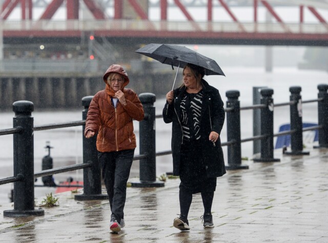 Two inches of rainfall is forecast to fall across much of Britain on Friday like the drenching Newcastle-upon-Tyne last week


